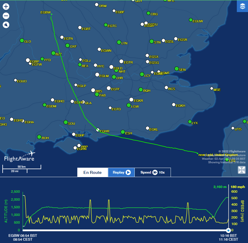
The FlightAware looks smoother than FR24 and likely more reliable (going down before climbing again on slow speeds)
Peter_G wrote:
That is why I have always encouraged people flying to Le Touquet, to fly Lydd – Le Touquet and to keep on Lydd’s frequency as long as possible because SAR (based at Lydd) are always monitoring ATC there.
Before you’ve even finished your first Mayday call, they will be airborne.
That is excellent advice which I will follow.
The altitude track on Flightaware, assuming it is not junk data, is consistent with entering some seriously connective weather and being tossed about in a powerful updraft before suffering structural failure.
Why else would one cross and 5000ft and then climb sharply when 3/4 of the way across. They actually go down before going up, did they try to get under a big cell and get sucked up into it?
is consistent with entering some seriously connective weather and being tossed about in a powerful updraft before suffering structural failure.
That was my guess but having flown midday bilmbling near Dieppe from Rouen, there was no TCU/CB in English Channel early morning but they did appeared later afternoon but there was plenty of lateral room to avoid (if doing dog leg fuel was not a concern for fuel & navigation), cloudbase was high and swaths of space between isolated fluffy and towered cumulus (there is the risk of flying under convective clouds and losing visual references, an IR pilot may elect to climb above to safe altitude and end up right into a cell…none of this is much of a worry over water with plenty of room left & right & under)
The FlightAware track (if not junk) looks like loss of control though rather than engine problems…
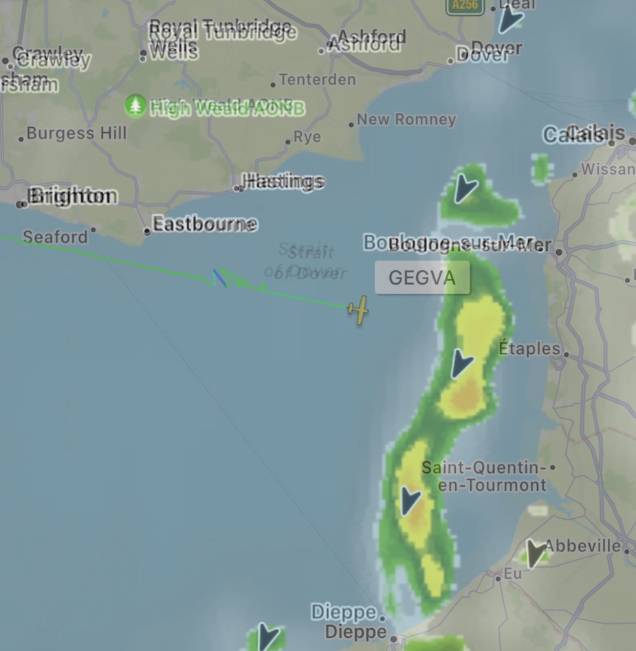
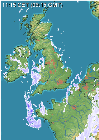
Just an approximate overlay. Radar 0900 UTC/ GEGVA0915 UTC (however I believe FR24 track after 0900 UTC is interpolated).
You can also get the meteox.com archive
This is around the time of the crash
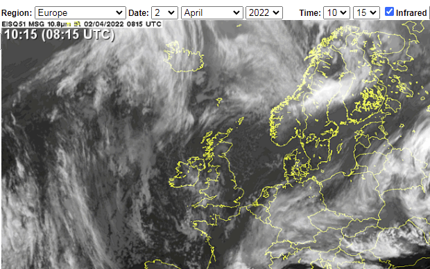
To show up on this radar, it has to be quite heavy wx.
Looking in the SAT24 archive, IR image, the cloud tops of that strip of IMC are probably FL150, plus or minus a few k
The FA track shows hand flying so probably no working autopilot.
Yes I agree the last bit of the FR24 track (the very straight part) is junk, but the FA track looks plausible.
Looks like it flew straight into that weather patch
There’s videos on Facebook of some significant weather at around the same time. Getting caught in something like that (IMC… icing… convective spouts) at 9am on a relatively sunny Saturday has the potential to go very wrong very fast. Would explain lack of radio call too.
https://imgur.com/a/iHaNR5h
https://imgur.com/a/Q3BwP8n
Poster in thread:
Yes. At the same time in the morning when the plane went missing. Landed just before the first plan landed in there group
Graham wrote:
The altitude track on Flightaware, assuming it is not junk data, is consistent with entering some seriously connective weather and being tossed about in a powerful updraft before suffering structural failure.
In that case (which seems likely) it doesn’t matter a bit for the occupants that they were over water at the time. It will make the investigation more difficult, of course.