

I was supposed to be in L2K this weekend but hate the cold si decided to do other stuff.
I was watching the Wx closely as I had friends that were still going.
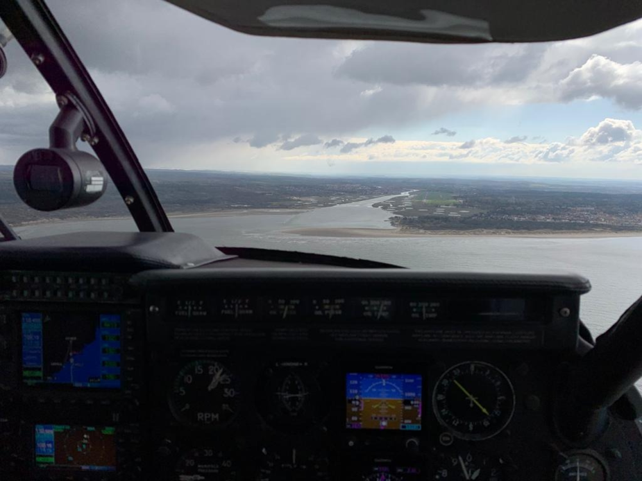
They sent me some pictures like Nb when they arrived.
I concluded that despite lots of Wx information looking like the flight was possible, it was a flight where some kind of radar wx images like those shown in this thread, were significantly important. If seeing those would yoi wait or even not go?
Good question. In this specific case, the line of showers had clear gaps in it and was travelling north/south, and our alternate was Lydd where it was forecast to be fine all day.
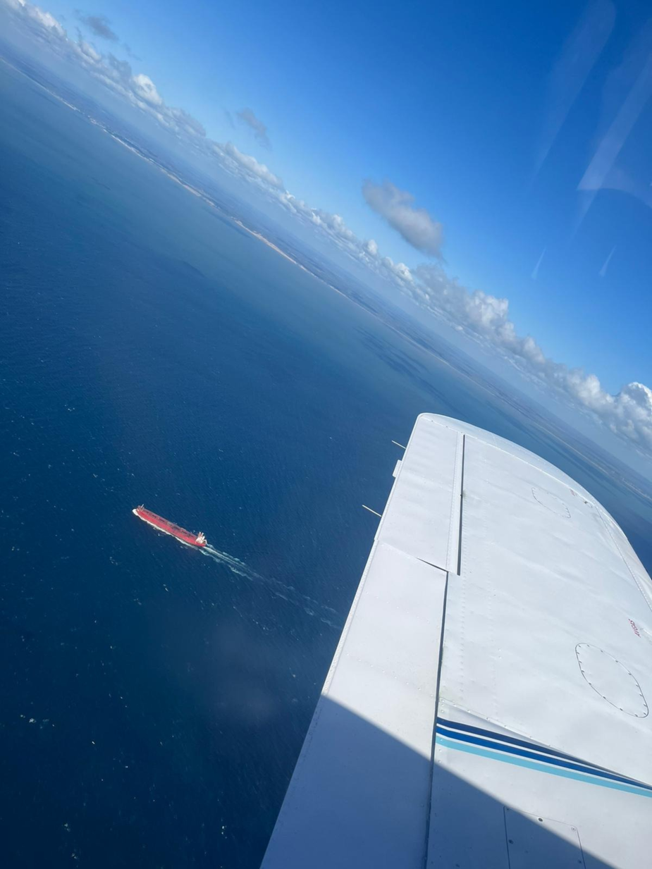
While we were steering around that nasty shower out the right hand side, here’s the view out of the other window:
alioth wrote:
I have a waterproof marine VHF handheld that (sometimes I remember to) I carry.
I really think this is a good idea for any (long) flight over water, it’s just basicaly illegal, at least in germany. I personally couldn’t care less if that is what saved me, I’ll gladly pay that fine.
You would need an SRC “short range communication certificate” to operate that radio and have that radio licensed to your boat. I cannot see that happening without the clerk in question going into early retirement due to work stress, because it’s obviously not a boat. And as if that is not enough, you’re not allowed to carry unlicensed radios in your plane as far as I know, so make sure nobody sees it during a ramp check.
You probably could fight through that legalese jungle, at least for flying boats having both types of radio is a necessity, but of course the government will stick their clammy hands down your pants to get to your wallet once again.
I’m just an engineer, what do I know, but to me it would make much more sense if our radios could communicate on the marine emergency frequency without modification in the first place. I mean it would be beneficial both ways, you could relay emergency calls due to the better radio range up high or help search, it’s not only that you could ask somebody to pick you up before you have to ditch.
But there must be something I am missing, because otherwise some rulemaker would be lacking common sense and that is unheard of.
Interesting story in this article: https://www.planeandpilotmag.com/article/flying-over-the-ocean/
After ditching, however, I’d rather have a PLB, the radio range of a handheld while swimming in the water is severely limited. In my opinion the best way is to carry it connected to your body, or, in case of flights over water, your life vest.
Best bet is something that alerts ships automatically if it gets wet
GA_Pete wrote:
I concluded that despite lots of Wx information looking like the flight was possible, it was a flight where some kind of radar wx images like those shown in this thread, were significantly important. If seeing those would yoi wait or even not go?
It does not matter what information you have? it’s always partial and forecast
Anytime you get airborne you my get nasty en-route weather at any point of the leg and you have to deal with: usually it require big detour with large big Avgas bills…although, I feel sad in this case the pilot likely did not seen anything at all: he was likely IMC at 5kft until he hit the nasty bit (not sure if it even shows on WX datalinks & radars “at the right time”), if you are VMC, you are lucky to see the extent of it and decide based on that
I guess it’s matter of expectations, if you are planning to fly intentionally near weather, you tend to have a solid plan to avoid it: you know where the vertical patches are and how to laterally avoid them, you know which way you should turn and how many degrees you need and where to go. If you are getting caught in one by surprise, the reaction could be very different and likely does explain the descent and climb as well as loss of control…
Probably, most pilots doing that run just gets tafs and metars. I know very few, even IFR pilots, check radar, sferics and IR as a routine thing, but if one did, this situation would be very obvious.
Problem with a departure Wellesbourne is that even if one looks at the radar immediately before starting up,it will take an hour before one hits the Channel. A lot can happen in the meantime. Most aeroclub pilots don‘t have a Golze.
So the only info he might have had a from a PROB group in the TAFs of airports in the area. And we all know that if we take these all too seriously, we would never fly.
That’s true, and I too generally fly with a PROB30 TEMPO TSRA etc, but – I did this earlier with the meteox archive – any earlier radar image would have shown something like this
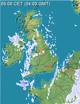
So, yeah, it could dissipate, but at least you would know there was a solid row of TCU-like stuff right across the route, and you could tell your passengers they might end up eating some cakes in Shoreham old town 


