Yep, that was exactly what the radar animation on Windy had been showing all morning: A reasonably good chance of seeing and avoiding the cells as long as forward visibility was maintained, but the possibility of surprise visit to Dungeness
Yes, in this case, the line was there all morning. So, if one looks only the METARs for Shoreham, Lydd, Le Touquet and Deauville, nothing at all might show up that even hints at any weather. I agree many pilots don‘t know how to use weather radar during preflight briefing.
The next Q is whether he was VMC or IMC when this started to evolve. In VMC, he should habe seen the weather and diverted. In IMC…,
well…, there are people who say one should not fly IMC in these small SEPs at all when the weather is convective…
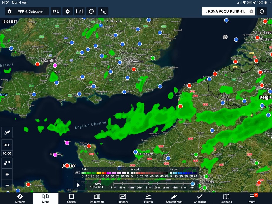
Foreflight has an excellent weather radar overlay and you can usually get 3/4G contact long enough for occasional updates, certainly in France, less so in UK. Although I navigate with SD in Europe, I always have FF available in the aircraft. Here’s the picture right now: (Note: this is not the day of the accident. I don’t have that screen, but would have expected to see areas coloured red and convective symbols).
On a separate note, I wonder if ATC warned the pilot about that weather? In the US, you could expect to be told about it, and even receive avoidance suggestions.
I wonder if ATC warned the pilot about that weather?
Forget it. Some isolated ACC/UACC and some local TWR/RDR and maybe even FIS units will give information or vectors (eg at a busy airport to minimize delays for an airliner inbound wave), but that’s not comparable to the US. Often got a convenient storm system avoiding reroute over the entire USA without even asking for it. US ATC is just great!
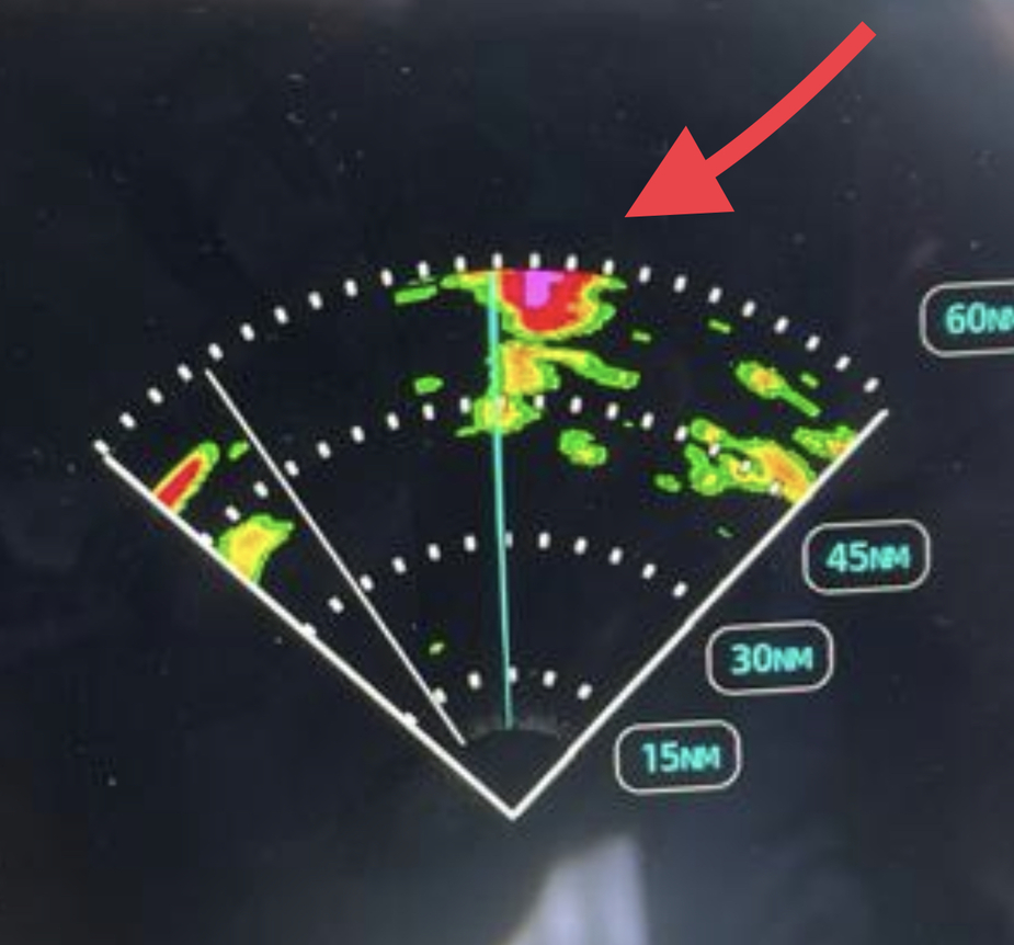
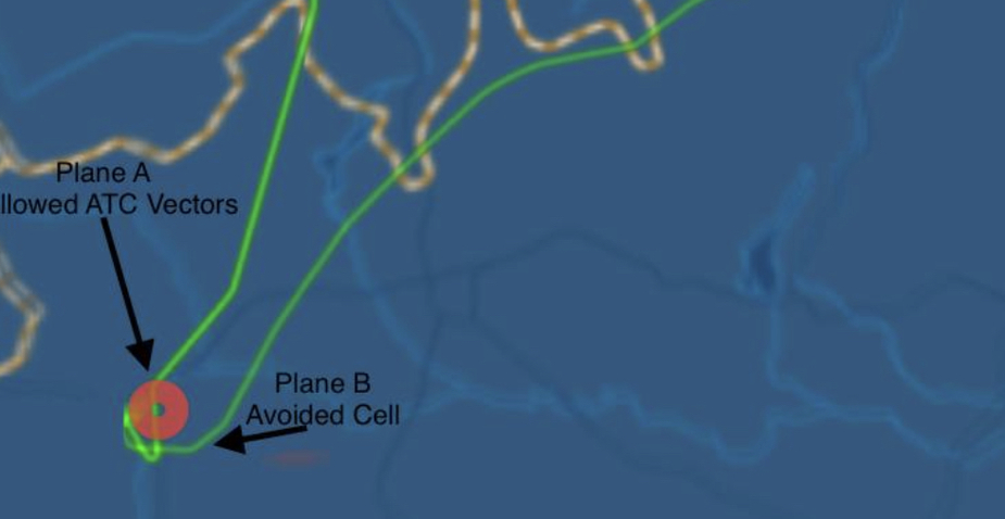
In Europe, beware! I know a TBM9XX owner who was vectored right into this by ATC, a big fat CB, with a couple thousand fpm updrafts and hail braking the wingtip light lenses etc…
Just to pick up on the Channel Islands comments from earlier, I flew Elstree <→ Jersey via KATHY and ORIST on Sunday and had no problem getting 7500-8000ft both ways in the Channel Islands zones. I did have to ask on the way back, but it was easy.
Arriving I had an early handover to Jersey about 15 miles before ORIST and was offered not above FL80.
On departure my initial clearance before taxi was “not above 1000ft via Cap de la Hague”, but I requested FL75 at the end of my read-back. During taxi I was told I’d have an early handover to approach to arrange that. Duly handed over at ~500ft AGL, and as I reached 1000ft I was cleared to “not above 3000” and perhaps 30 seconds later I was cleared up to FL75. Those of you with an IR could obviously got up into the class A above FL80.
The instruction for IFR departure in Jersey was always climb 5000ft on QNH, I doubt they clear for FL80 on the ground (you get passed to approach before swapping to 1013 anyway)
They do keep one very low on VFR departures, you are likely in the water if anything happens unless you cross to the OCAS in France…
Ibra wrote:
They do keep one very low on VFR departures
I like to think they offer a low level, but it was about as much work to request and receive FL75 as typing this message, so I recommend doing that.
Winston wrote:
I like to think they offer a low level, but it was about as much work to request and receive FL75 as typing this message, so I recommend doing that.
I always ask for much higher, but the degree of ease with which it is forthcoming is highly variable. One one occasion the controller made no attempt to hide his irritation at having to coordinate with his colleague and seemed shocked that I should consider 2,000ft unsafe.
On the weather this weekend, I flew both days and noted that the weather followed the same pattern. Severe CAVOK with the frost in the early morning, puffs of cloud appearing and growing into impressive build-ups and localised hail showers by mid-late morning. Evidently it developed a bit earlier and a bit more severely further south, looking at what was in the channel.
Both days I took passengers new to light aircraft, both in the morning, and the weather was something they were interested in. On Saturday we played in and around the early morning puffs of cloud, just for fun, and then I remember afterwards remarking over coffee to my passenger that some of the clouds had now developed into things you wouldn’t even think about taking a light aircraft into.
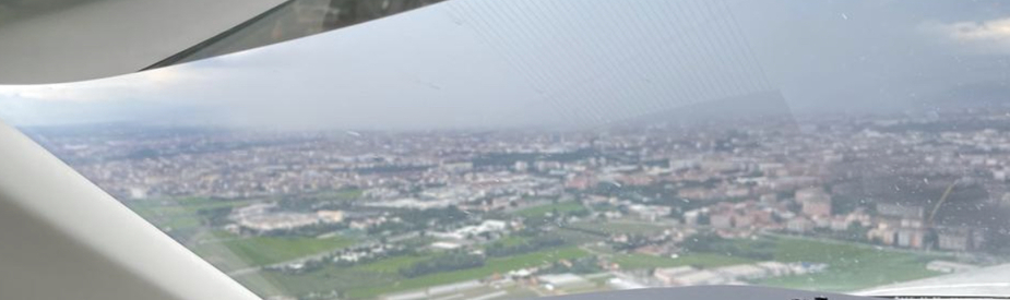
I flew out at 0950z from Stapleford, so was airborne probably an hour or so after the event. Managed to find a gap away from any clouds in the climb via DET, Thames & London extremely helpful as I navigated around some TCU.
Once in the cruise (FL110) was given direct LFAT, but had to request a deviation around a CB cell with tops slightly above myself, had to deviate towards DEVAL before making descent and right turn into LFAT but the option was to return to the UK if things did not pan out as I hoped. Looking at the Golze there were 3 or 4 CBs ahead of that one and another two or three right behind the one I avoided.
Pretty dark bases but not very high in nature at that time.
You probably know this but do yourself a favor and don’t avoid based on satellite weather radar images, too much downlink delay.