I am no meteorologist and can’t really read those pressure charts (and have never met anybody who can in a way actually useful to aviation – as opposed to answering JAA IR Met questions) but the trough shows likely convective activity in the whole area.
The actual position of the trough line is not in itself meaningful. It is a symbolic marker really.
I would not fly the route at 1630Z or later, but I would not fly most routes in Europe that late in the day unless the wx was very obviously totally clear. We will be getting airborne 0730Z.
We’re planning to depart tomorrow (thursday) late afternoon, EHLE-LOWL. But the weather doesn’t look too promising, with expected convective stuff over Germany:
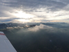
Let’s hope the actual sat images will look a little bit better 
Sorry guys, I can’t make it. Have fun.
FWIW, closely spaced TCUs or CBs over a large area (as opposed to being in a line) are unlikely, because there would not be any air left underneath for them to suck up.
Generally they are scattered.
The crucial bit to avoid is getting into any solid IMC while flying in an area populated by them, because one then can’t avoid them visually.
In weather like that I usually fly VFR. This gives me more freedom and allows me to fly much lower over the Alps. On a hot convective summer day, there is no IMC that you would enter if you want to stay alive so VFR does the trick. Germany and Austria has very little restricted airspace and starting in Slovenia, there is no difference between being VFR and talking to FIS and being IFR and talking to ATC. They treat you just like IFR traffic.
Out of interest, can someone explain the significance of the number next to the lightning symbol on these PDFs, e.g. -1.7, -3.1? Or provide the technical term that I can Google?
Out of interest, can someone explain the significance of the number next to the lightning symbol on these PDFs, e.g. -1.7, -3.1? Or provide the technical term that I can Google?
https://router.euroga.org/wiki/gramet/#Thunderstorms
My plan for tomorrow is Rotterdam Annemasse (Geneva) and sleep in Venice.
Looking at the latest weather it seems going more easterly is much better. In that case it will be Innsbruck .. and then ?? Venice?? Pula?? Rijeka??
I do not think I will make LDLO tomorrow (thursday) as I need to land before 16:00 local.
Friday I hope for a daytrip to Dubrovnik and then mid afternoon at Mali Losinj.
I am planning to fly this late afternoon to Ljubljana.
Looking at the latest weather it seems going more easterly is much better. In that case it will be Innsbruck .. and then ?? Venice?? Pula?? Rijeka??
Why not stay in Portoroz (LJPZ)? Since it is still off-season you may even get a competitive rate at the Kempinski not far away …
From LJPZ it’s 30 to 50 minutes to LDLO, depending on aircraft. If you make it to Pula or Rijeka, it’s only a few more minutes to LDLO.