
Cobalt wrote:
The sun. Not kidding, we had two beautiful days, hence mo uploads of photos uet, to busy admiting the scenery.
It seems like you were so moved by the scenery that you cannot write English anymore 
Why did you go to Hovden by the way?
The sun. Not kidding, we had two beautiful days, hence mo uploads of photos uet, to busy admiting the scenery.
Cobalt wrote:
The VFR guide does not mention Schengen at all
I know. You should drop the CAA a note, telling your story, so they get it updated for the 2016 version

Cobalt wrote:
Also norway AIS which i used for filing happily confirmed they would notify customs…
And they obviously did  Why did you go to Hovden by the way?
The VFR guide does not mention Schengen at all, it just refers to international flights. Also norway AIS which i used for filing happily confirmed they would notify customs…
Cobalt wrote:
they were expecting us to land at Hovden as planned
Hovden don’t have a customs office. The exception is smaller airplanes, MTOW 5700 kg max 10 passengers and from a Schengen country.
Yes, for the scenery. Hence i stayed below cloud.
I have just arrived in Henningsvaer, after landing in Svolvaer on the Lofoten. Fantastic trip, weather was great except for an hour towards the end, aircraft all working well, but the Bureaucrats did their best to throw up roadblocks… Which resulted in an unscheduled landing at the request of the Police who claimed we had to land there for customs despite meeting the prenotification requirements at the original destination. And when we finally talked to Customs on that airfield thay wanted to know what we were doing there, they were expecting us to land at Hovden as planned and were clear we could have done so…. Ho hum. So now we were stuck in the passenger terminal of an airport with no Avgas – so a 15 minute hop up the road to get some fuel and on we went… other than that waste of a perfectly good hour and maybe 30 minutes extra flying time all was well.
Photos to follow when I have the time. Off to dinner…
Beautiful photos, especially of the Scottish scenery. I hope the recent weather hasn’t dampened your ardour too much.
After 45 minutes or so to take on fuel and pay the landing fees, we left Oban for Lerwick/Tingwall on the Shetlands.
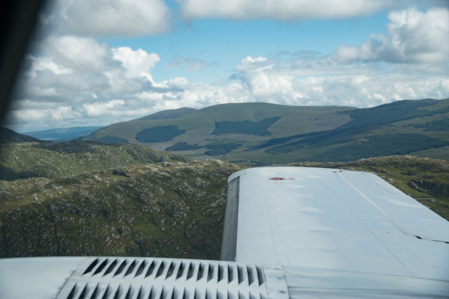
Plan was to follow the valley from Ft. William to Inverness and then follow the coast, overfly Kirwall and carry on. With a few showers around, initially it did look not to great… This was taken immediately after departure at 2,000ft looking towards Fort William. With Fort William clearly visible in the distance (30+ km) visibility is great, but no exit is visible, so need to turn around or to climb.
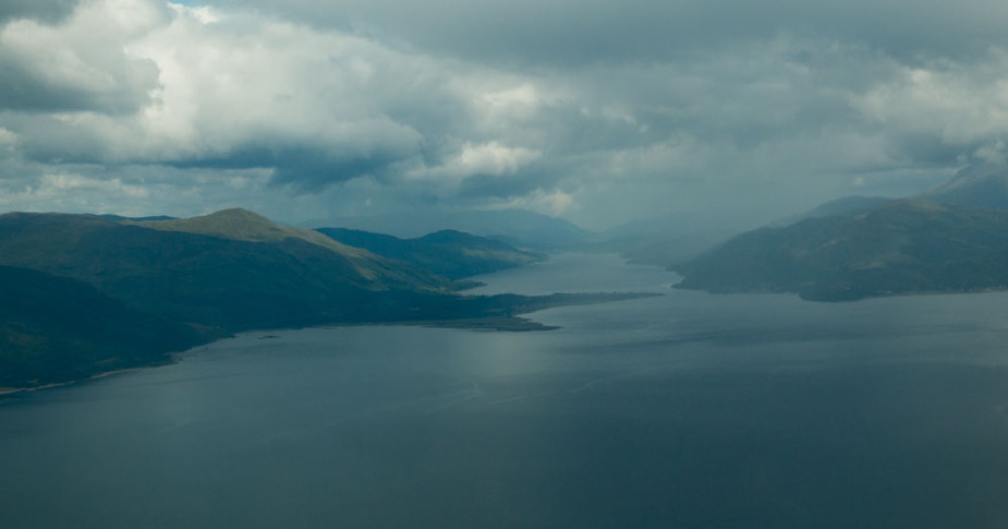
As things progress, visibility stays the same and even improves – this is past Fort William, overhead Loch Lochy at 2,000ft with Loch Ness visibile in the distance… so looking very nice and safe that way…
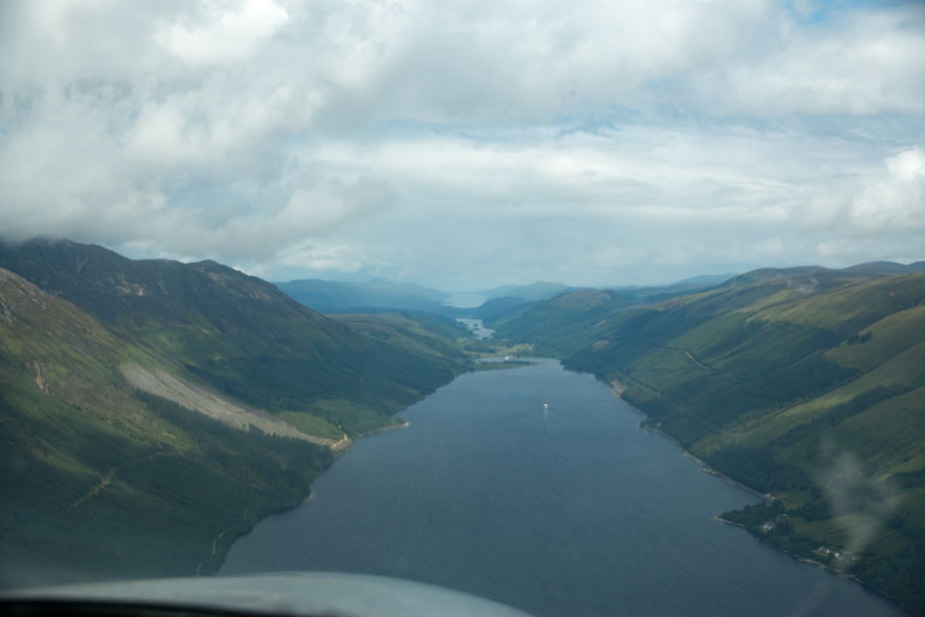
…but the view sideways, with terrain raising to above 3,000ft, takes some getting used to. At the altitude (2,000ft) the valley is maybe 3 miles wide. A 180 at a moderate angle of bank (30 degrees) takes more than a mile, and at 45 degrees AOB something like 2/3 of a mile, so normal valley flying tactics are to stay close to one side of the valley. Plan B in case I can no longer see more than 5 miles ahead is the 180, plan C is a climb, so I fly this with a waypoint set up at the exit and the HSI needle nicely in the middle – so if I can initiate a climb I can use that to stay in the valley until I am at a safe altitude. Which takes 5 miles. Yes, I worked that out before the flight – not something I want to wonder about when already in the air.
Trying to talk to anyone in the valley was pointless – in Scotland, nobody can hear you scream, as the movie title goes.
As we coast out past Wick, a small spanner in the works – Scottish advises us that Sumburgh has some sort of power failure, and only the tower frequency is available. As we get closer, they inform us that they will not issue any clearances, and also that we cannot continue with Scottish because their repeaters on the Shetlands are out of action. My wife reassuringly tells me I should talk to her instead, so we carry on, although at this point Sottish makes it sound like the problem is Shetland-wide and our destination might be closed. We carry more than enough fuel to return to Wick, so we carry on, hoping that the FISO at Lerwick has either power or a hand-held. Shetland is not a Highlands-and-Islands airport but a local affair, so cannot use the out-of-hours permission there…
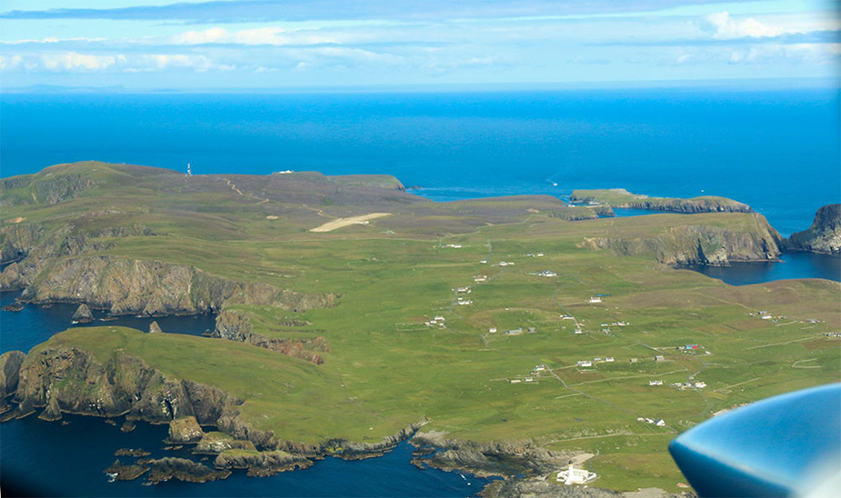
This is Fair Isle (basically 20 houses and an airstrip)
Nothing improves, so after passing Fair Isle we have to dogleg around the CTR. Sumburgh can’t raise Lerwick so have no idea if they are open or not. Ho hum.
Now, why on earth do they have to close the airspace when the radios are down? They still had one frequency, they had primary radar (they asked us if we were the aircraft south of Fair Isle at some point) – why don’t they just revert to Class G and at least allow operation, if they can’t offer a service? So we fly a dogleg around the zone (thank goodness for GPS – would have been a bit trickier without it, probably a 15NM DME arc around the VOR/DME and then dead reckon northwards) and proceed towards Lerwick, which was (a) open and (b) unaware of any problems with power, so must have been a Sumburgh thing.
Time flown: 1:50; exactly as planned – we skipped the leg via Kirkwall (we had seen enough for one day) so that saved the time we wasted going around the Sumburgh airspace.
Day 1 report – delayed by one day…
It all started out quite nicely – although there was some lower cloud lingering longer than forecast, by the time I got airborne (09:00 local sharp, Biggin got me out as soon as they opened) it had all cleared up nicely. Biggin coordinated with Heathrow Special, so we got a sqawk before departure and an immediate handover, which was great because departing from Runway 29 one reaches the City Zone boundary rather quickly.
After London ensuring we were indeed in a twin we were cleared the usual route – London Eye / Alexandra Palace (alley palley in local ATC speak – ugh!) not above 2000ft…
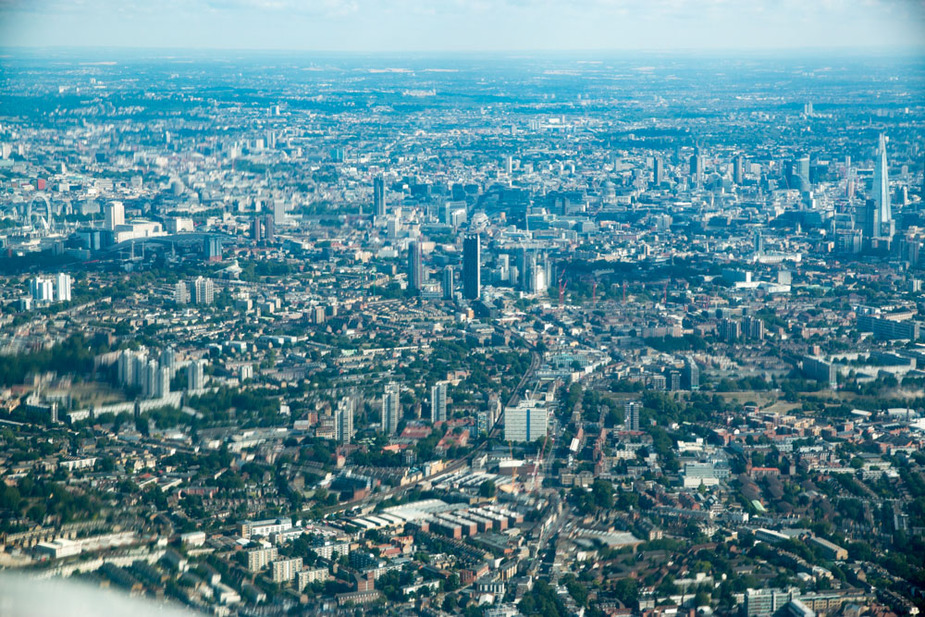
The controller handed us over to Luton, where we also got the usual clearance via just east of the airfield again not above 2,000 ft, As soon as airspace permitted, Luton offered us a climb, so we went up to 3,400ft. East Midlands did give us a crossing at that level, so the “straight line to Scotland” plan was working nicely…
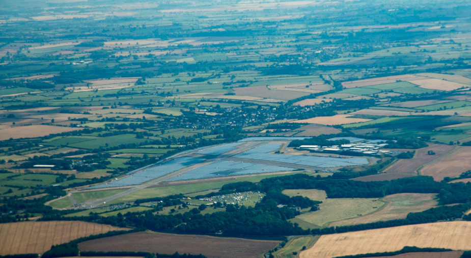
This is Wymeswold, an airfield-turned-solar-park near East Midlands. Strange they kept the runways clear…
We carried on towards the lake district, dropping down to 3,000ft as we progressed – we had the choice of going above cloud or stay below. There are some hilltops (sorry, “peaks”) just above 3,000 ft there, but everything is nice and wide, so to get us used to flying near terrain we decided to stay at 3,000ft.
Windermere was first, of course….
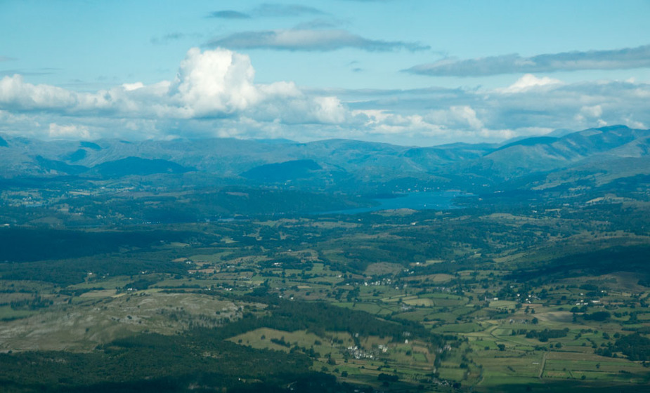
Looking north towards Thirlmere
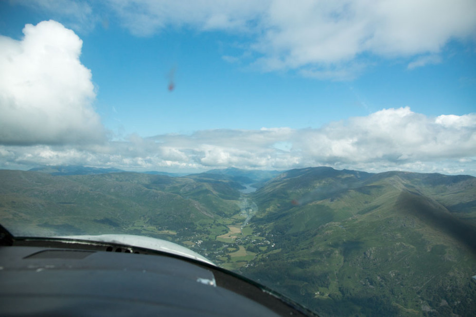
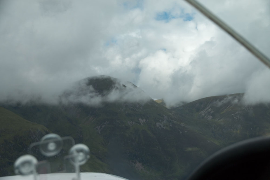
This was near the Derwent Water, around ridge level slightly below the Skiddaw (3,100ft). I actually flew towards that ridge to check the EGPWS warning times before I turned, would post the video but my PC card reader has packed in. Warning was in time to initiate a normal turn (25 degree AOB) and remain well away from the terrain. Not something I would want to rely on, but reassuring. Checking the track later with Skydemon, the lowest VERTICAL terrain clearance crossing the lake district was 900ft, closest HORIZONTAL distance was around 1.2km, where the below photo was taken. Given some of the Fjords I will fly in are two miles wide, I’d better get used to that image…
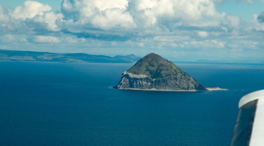
Since Biggin got us out early, we took the scenic route around the Mull of Kintyre and up the coast. Progressing further towards Oban, here one of the many random rocks sticking out of the water – this one is Ailsa Craig.
Arrival was uneventful. Time taken 2 hours 50 minutes, with 3 hours planned. Good progress so far.
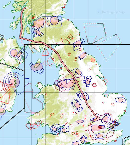
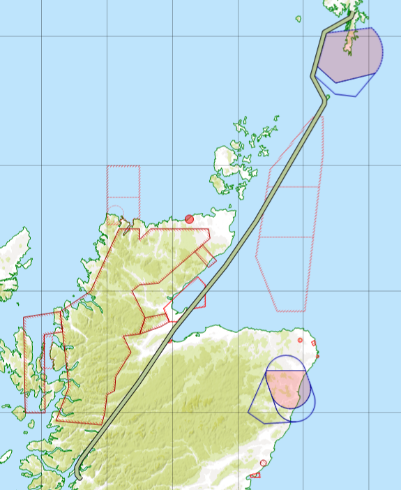
Track starts near Luton because I only fired up Skydemon at that point.


