
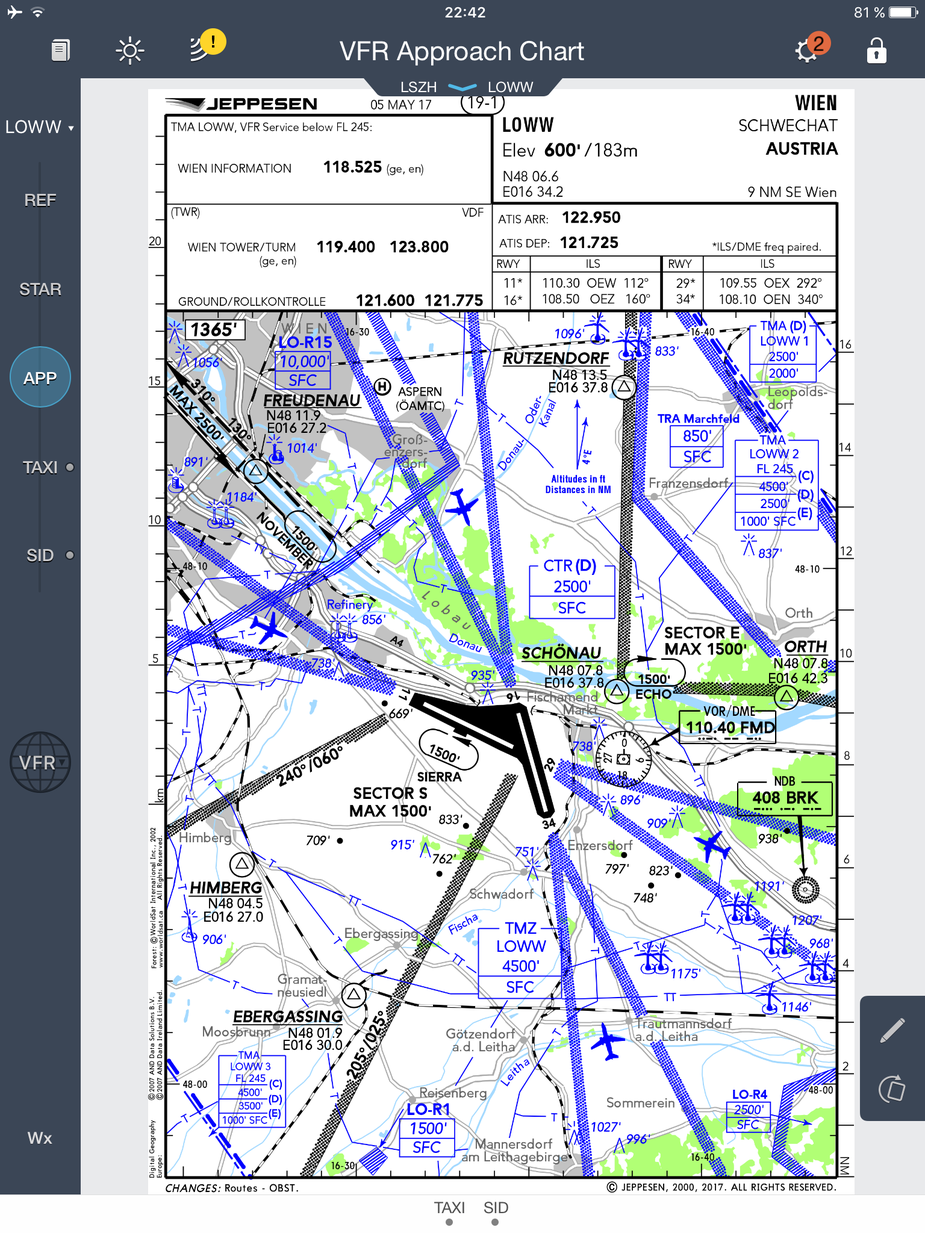
Sorry Peter, this is the type of VFR chart Jeppesen shares with Garmin. I suppose it’s the same plate with others:
For VFR enroute in Europe, I don’t think ForeFlight 9.4 adds anything at all. I still consider it to be unusable for VFR outside the USA where they have the scanned sectionals. Garmin Pilot isn’t great for VFR enroute either but at least they offer a lot more detail on the map (such as airspace altitudes) and they offer the various CAA issued VFR maps.
@supik that is a VAC – VFR Approach Chart. Not a VFR enroute chart.
Jepp publish the VACs and the airport charts under the heading of “VFR Europe” (also available broken down by country e.g. “VFR Germany”) in their generic Jeppview/JeppFD/JeppTC product. It’s a few hundred € a year I believe.
Here’s the JeppFD VFR chart.

Still some way to go then – no frequencies by the VORs and not enough information by the airspace. No obstacles shown or have they been switched off?
OK; that’s interesting. I guess this is what came with Flitestar etc for all the years past. However “nobody” in Europe has used Flitestar for VFR for many years.
That chart needs improvement for legibility. For example the railways are too visible, yet few pilots who might use a GPS follow railways  What matters most is airspace and its class and the vertical boundaries – that is what will get you into serious trouble if you enter it without a clearance and in most of the UK you cannot ever get a clearance (because it’s Class A). After airspace comes ground and its elevations, especially spot elevations, then water and cities. You need to avoid cities due to the glide-clear rule.
I would think the best thing that Foreflight can do for Europe (which is really a nonexistent entity – Germany has as much in common with France as the USA has with Brazil, in this respect) is to license something like the Air Million chart. That chart is published as a raster only but obviously it is on CAD so a vector database could be generated. The two main products here (EasyVFR and Skydemon) have generated their own databases.
And here is the same chart as Dave showed in Foreflight. It is the same as JeppFD VFR.
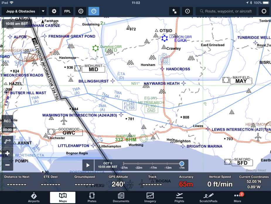
Looking at current Flitestar, this is the “VFR” chart, with everything turned off except CAS and airports

This is “Euro VFR”

This is “default”

Have CTRs been turned off in Jason’s post immediately above? Gatwick’s Class D should be shown, along with Shoreham’s CTA, etc.
I guess Jepp wouldn’t license the MFDVFR data. It’s too good to license to a competitor…
I think it is a case of zoom level and decluttering Peter. 


