
achimha wrote:
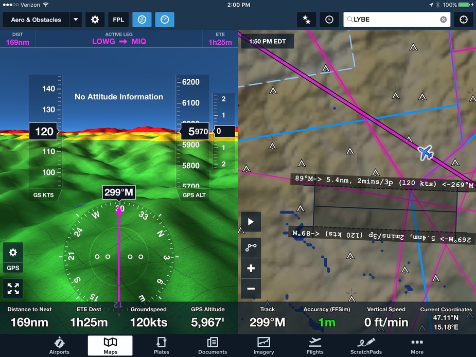
I can’t get it to display anything better than that (Munich area)
Have you downloaded the high resolution terrain for Europe? Your picture around Munich doesn’t look like the high resolution terrain that I see around Salzburg for example:
It’s still not really great terrain, but is similar to the terrain in JeppFD. I understood that one of the highlights of the FF – Jepp agreement was that FF would get Jepp’s terrain mapping, so perhaps that’s all we get.
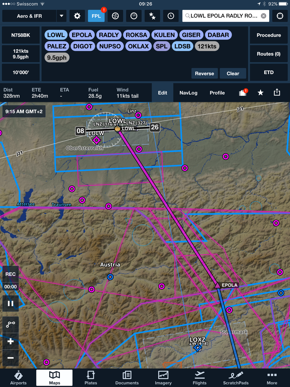
Terrain is one thing but there are almost no map details for orientation and the airspaces are not labelled which is important for VFR. That’s not really a VFR map I’d say. You want to have towns with names, roads with names, railway tracks, etc.
Peter wrote:
it comes with the nice Jepp VFR charts (effectively the “VFR Europe” part of Jeppview) and, for pilots flying in Germany, there is extra value (50 quid?) because Germany charges for its VFR airport charts!
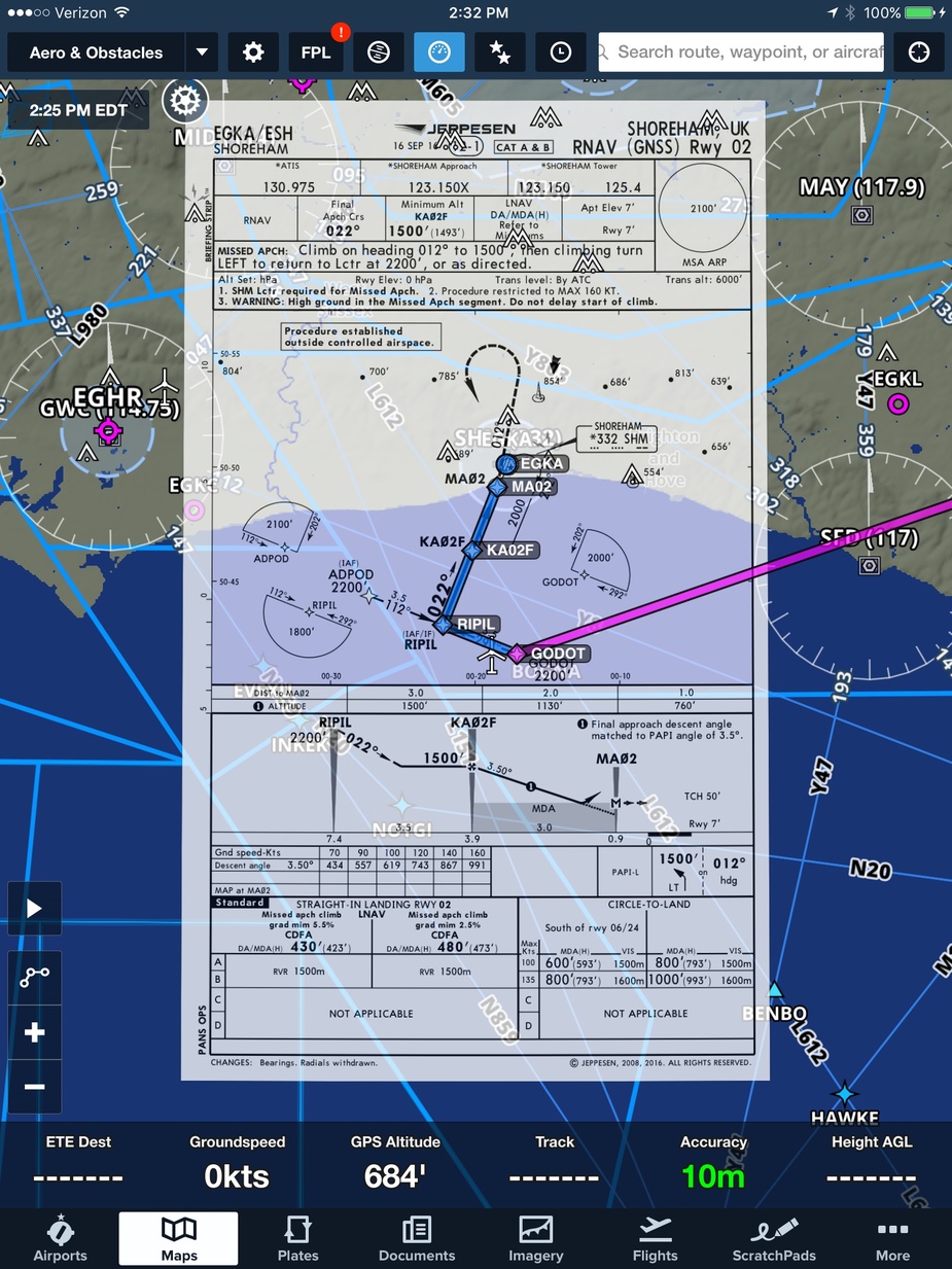
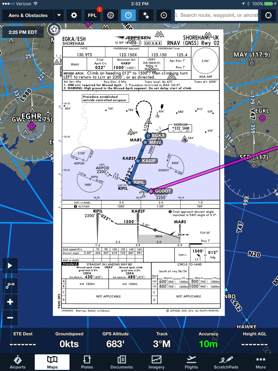
These Jepp VFR VAC charts are included in the FF All Europe IFR & VFR subscription, as well as all IFR IAC for Europe. It’s not cheap at $889 + FF sub, but a whole lot less than the JeppView/JeppFD price for all Europe IAC.
NCYankee wrote:
NCYankee 15-Jul-17 15:42 #37
chflyer wrote:
I have an open question about the IFR coverage as it doesn’t seem to include Poland, Czech Republic, Slovakia, Hungary, and Baltic States.
The Jeppesen coverage map shows all of these in the All Europe coverage you mentioned. There is a Northern Europe that is a subset of Europe for $367 that limits coverage to Scandinavia, Germany, France, and UK, Ireland.
Yes, so I expected those listed. They are missing from the All Europe coverage at the moment even though they show on the coverage map, which is why I raised the question with FF.
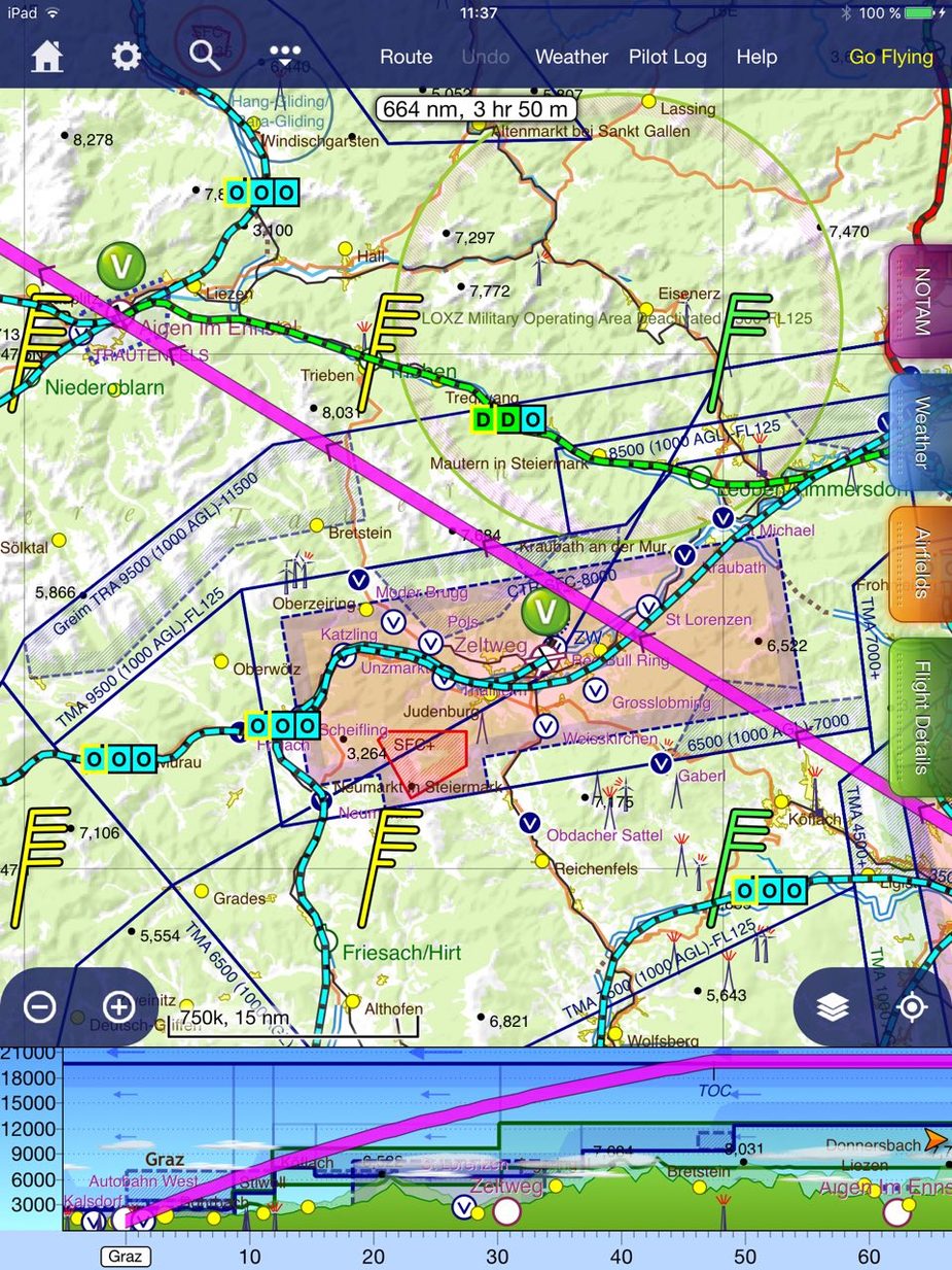
I have these images from NCYankee:

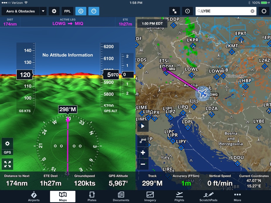
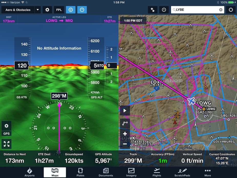
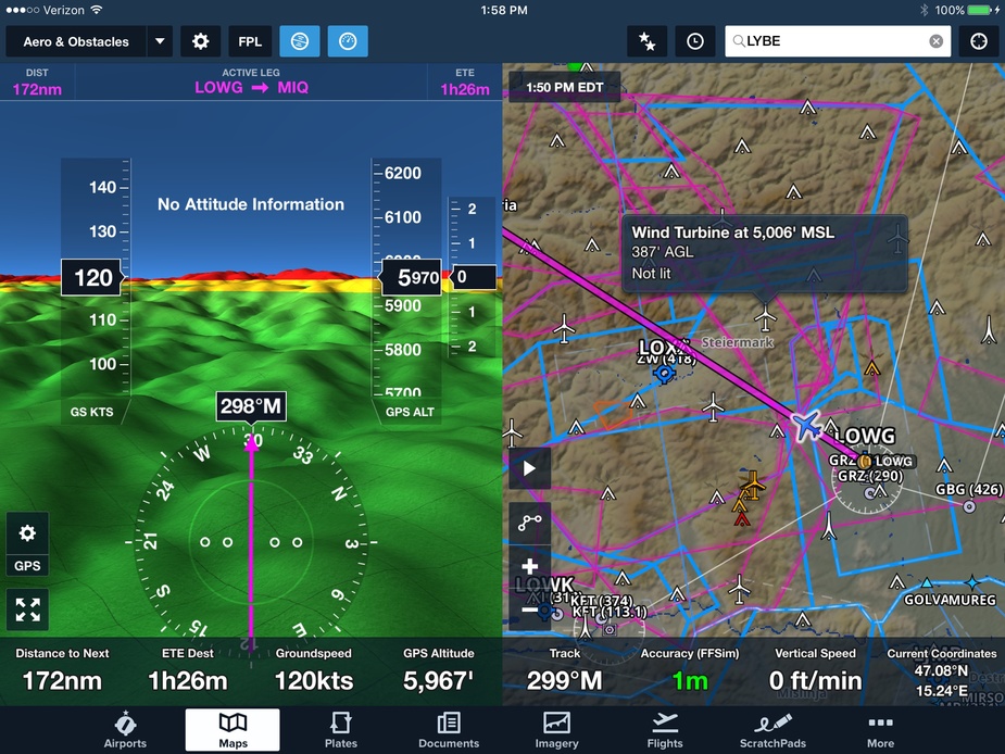
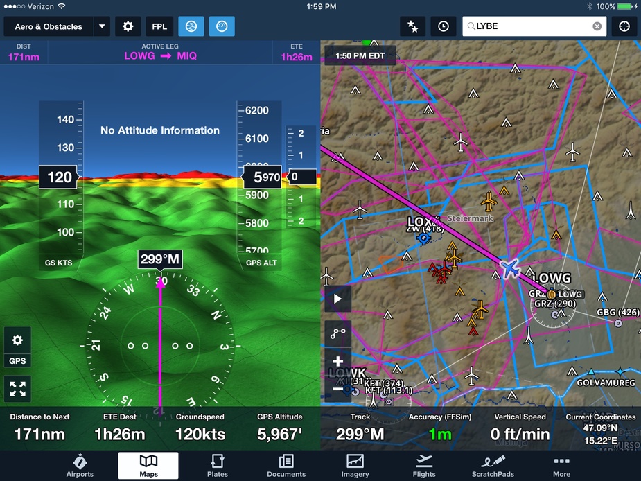
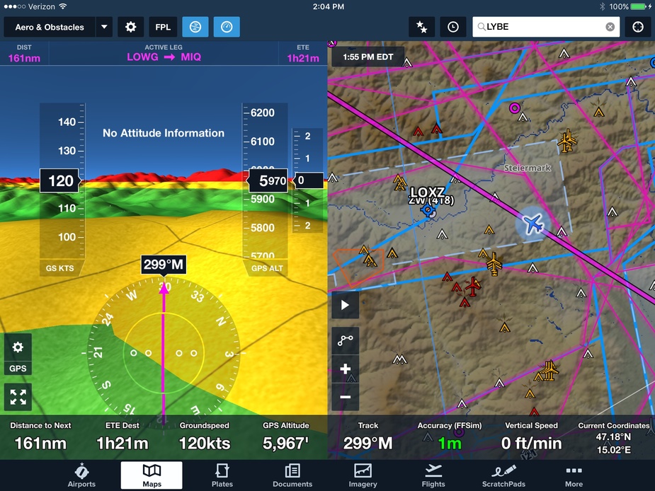
And that’s what SkyDemon looks like on that route near Zeltweg. You can clearly see that this is actually VFR map with details on cities, streets, railways and airways have altitude labels like on a VFR map. You don’t want to click on every line to figure out airspace altitudes.
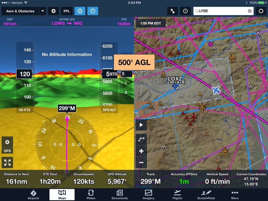
What FF has right now is not of much help when flying VFR.
Garmin Pilot isn’t anywhere near SkyDemon either but at least it has airspace altitudes and visual reporting points and a lot more geographical detail.
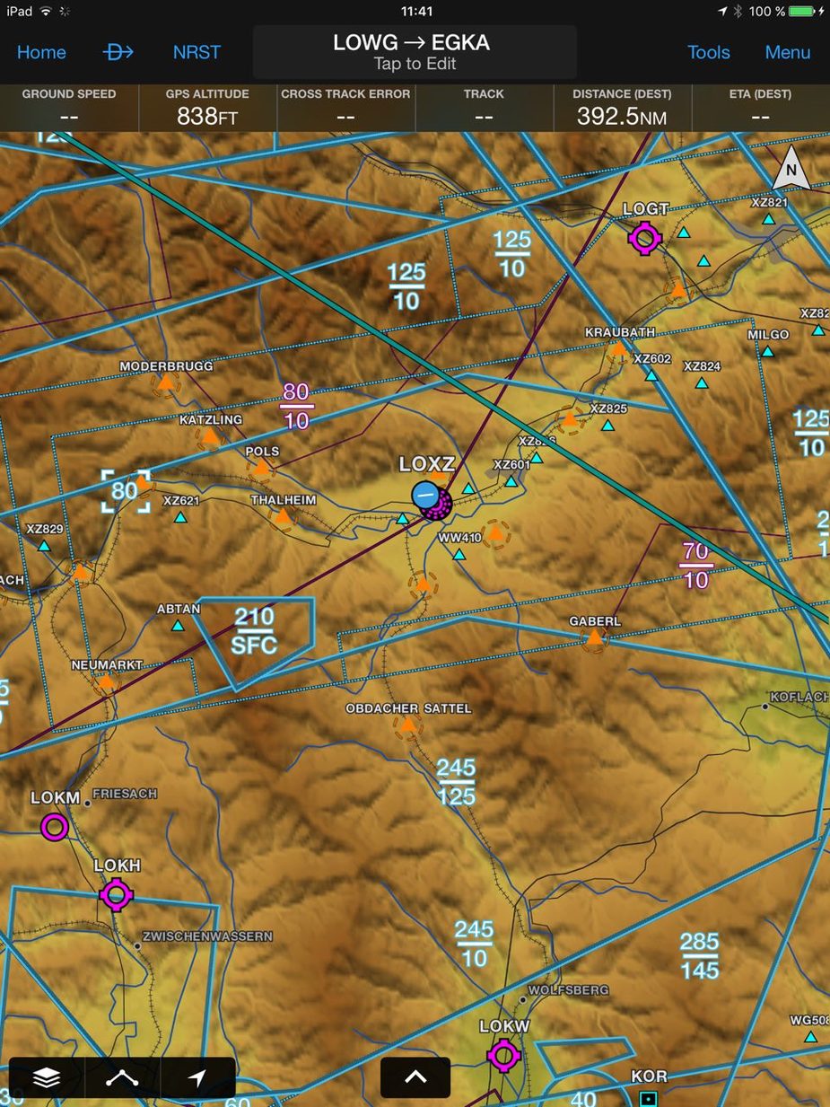
FF certainly doesn’t seem to have the VFR mapping to match SD or EVFR for that matter either. If they were expecting the JeppFD mapping to serve the purpose then it will come up short compared to those VFR tools. FYI, clicking on the street map as well as aeronautical map does bring up more geographic detail but slows down the app too.
My interest was a way to get a cheaper route to Jepp IFR coverage plus their VFR VAC charts. If one is happy with all the country-specific format but free IAC charts, then the VFR tools are very price-competitive even with the need to pay for the very expensive CH & DE add-ons. I’m not aware though that either SD or EVFR do geo-referencing of the IAC charts although they do it for the VAC charts. But that might not be a priority for many.
At this stage, there still seems to lack a single product that addresses both IFR and VFR needs, like FF does for the US coverage. It would seem that FF is addressing the Europe JeppFD IFR customer base first.
At least there is movement and it will be interesting to see how it all develops.
The classical US solution to VFR mapping has always been very simple: take the free of charge sectionals, scan them (initially until the FAA started doing that) and pan them on the screen. Until today you can see the stitching marks in FF.
VFR for Europe requires a technologically much more sophisticated approach and this is where SkyDemon, EasyVFR and Jeppesen MFD VFR excel. From a software engineering point of view, this is a much harder problem to solve, both the data you need and the algorithmic complexity to present it well.
ForeFlight has already announced that Jeppesen enroute charts and VFR charts will be integrated this summer. I expect that they will also evolve over time as customer feedback is provided. Most of the employees at ForeFlight are pilots and ForeFlight has subsidiaries in Europe. ForeFlight is in its early stages with the support for Jeppesen.
There are no Jeppesen VFR enroute charts anymore… Unless they struck a deal with Jeppesen MFD VFR, the product from Jeppesen Germany that shares nothing with the rest of the Jeppesen world but only covers a few countries. Even that product doesn’t have charts in the sense of scanned sectionals that FF uses for the US but renders vector maps.
It will be interesting to see what FF come up with.


