Actually if you google you find it is real. It is currently doing the social media with the caption “USS Al Gore global warming research ship” and that bit is fake  There are various pics of it.
Whether it actually is freezing rain I don’t know.
You are probably right
https://www.rojakpot.com/uss-al-gore-hoax-debunked/
The other explanation is he left the freezer or the aircon ON (for those who enjoy their boats)
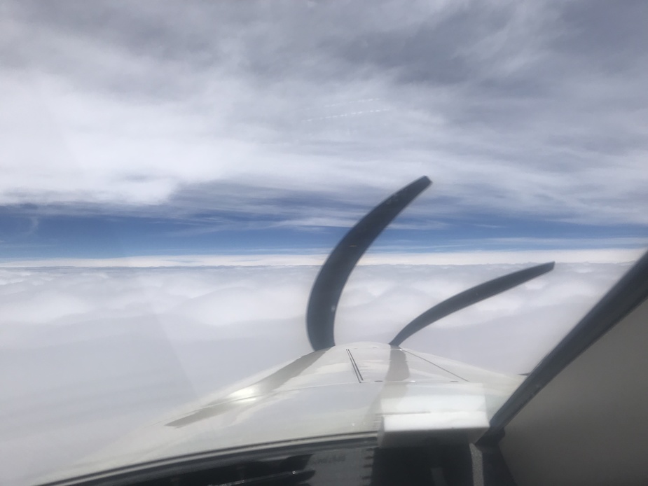
Yesterday around 14h30 local in the area of Linz, Austria we got some serious icing at FL280 and -34C. I have never seen icing that way up and that cold. Has anybody else here seen such a thing yet? The weather did also look quite calm with no convection just ordinary clouds. But ATC told us that a few minutes before an Austria Airlines flight apparently did even turn around and flew back to where they came from.
Yes, I had it once and was surprised too. I Wrote about it in this thread.
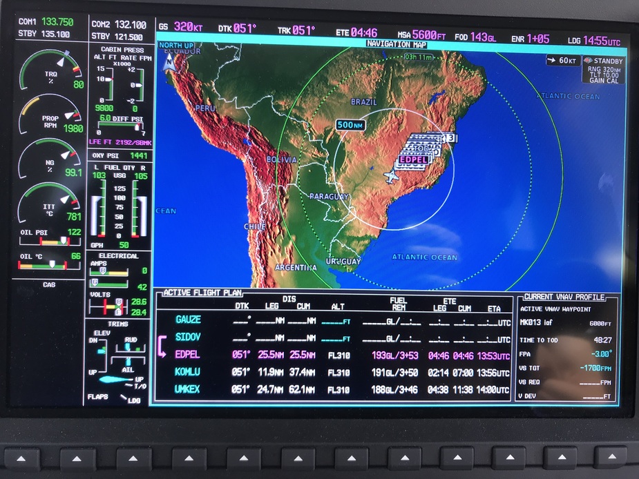
Foz do Iguazu SBFI to Montes Claros SBMK to Natal SBSG
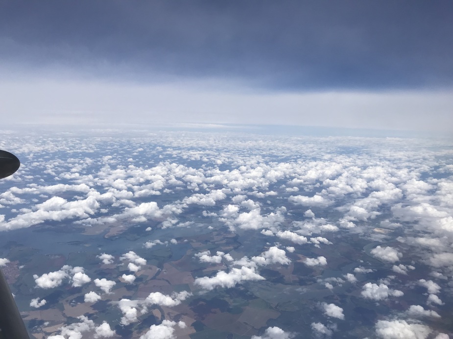
It was one of the 2×1000NM days. All good, but the clouds near Montes Claros were very high. At FL310 we were barely above. As soon as we touched these clouds, ice showed. It was first time that I saw icing at -35C.
It is standard procedure to use anti icing between +10 and -40 and visible moisture on the jet I’m learning to fly now. I guess it is not common but does happen sometimes.
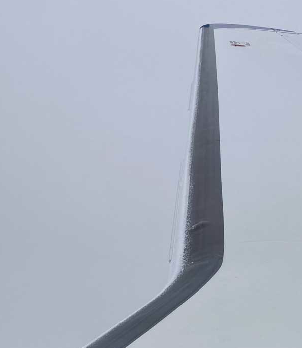
This is what it looked like at F310 before descent:
@Sebastian_G that would have gotten my attention fast! What did you do?
Hi Sebastian,
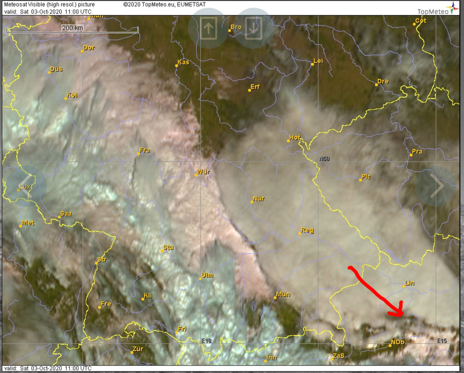
the origin of the cloud has something to do with leewaves, see picture below (13 LT). In leewaves you can have very strong updrafts. Glider pilots flew more than 1000 km that day east of Zell am See using those updrafts. In leewaves there is absolutely no turbulence (pure laminar flow) hence no reason for the cloud droplets to freeze immediately. And due to the strong updrafts there are generated a lot. They will do but it takes time. Maybe 5 minutes or 10 or even longer. I have seen liquid supercooled droplets down to -35°C (by touching lenticularis clouds with one wing in a glider).
denopa wrote:
@Sebastian_G that would have gotten my attention fast! What did you do?
We went down from FL280 to about FL180 as I was afraid to operate the boots at such low temperatures. The manual says they work down to -40C but as I know what a set costs I did not want to try them below -20C unless necessary.
Karl_Acht wrote:
the origin of the cloud has something to do with leewaves
Thanks a lot for this new insight. Very interesting and I will try to look into this further.
Sebastian_G wrote:
Thanks a lot for this new insight. Very interesting and I will try to look into this further.
Nice explanation. I got mine near elevated terrain with wind towards it too.
In half hour of flying it went from this to the picture I posted above.
loco wrote:
I got mine near elevated terrain with wind towards it too.
That’s a nice gliding range you have there with that green circle (just joking )
I am assuming lenticular form +60kts westerlies hitting the Andes don’t go unnoticed even at 1000NM downwind?