Peter wrote:
(a) Do you have a VFR chart running as a GPS moving map, and I mean a real chart, not some synthetic version,
Sorry Peter, I know you are a fan of Oziexplorer and what you call “real charts” but what makes an electronic version of a paper chart better than a computer generated chart? At least the latter can be updated with new obstacles for example. How do you do this on your chart. All software running an electronic chart will also give you terrain and obstacle warnings. This must surely be better than a rasterized paper chart which could be up to a year out of date.
JasonC wrote:
I cannot believe people contemplate flying below a 1000ft cloudbase VFR. They must have a death wish. Either get an instrument rating and fly higher or stay on the ground.
I did that reasonably much before I got my IR. Absolutely no problem if the visibility is good, the terrain reasonably flat, you have a proper chart, and the weather is constant or improving.
Can you explain exactly what the problem would be rather than making blanket statements about “death wishes”.
The main issue to me is navigation, but these days with GPS it’s less of an issue.
As with all other types if flying it depends on that you know what you are doing and that you know your limits.
When i was still VFR only and occasionally scud ran – with an airplane with good slow and low flying qualities – i thought that all those guys who fly through ice and bad weather in spam cans or in FL250 with masks are crazy. I still don’t like flight in non press. a/c up there.
I mean i know guys who fly over the Alps in IMC at night and think that’s ok. Flying under a 500 ft ceiling in the rain with 3 or 5 miles visibility in a Cub is much safer than that.
Actually if either ceiling or the visibility are ok then scud running through (more or less) flat land can be very safe. In a Warrior, 172 or especially in a Cub, planes that you can land on any meadow .. no big deal.
I mean i know guys who fly over the Alps in IMC at night and think that’s ok
In a SEP, that’s Russial roulette if the engine fails, so not in the same league
Sorry Peter, I know you are a fan of Oziexplorer and what you call “real charts” but what makes an electronic version of a paper chart better than a computer generated chart?
The topographical detail.
At least the latter can be updated with new obstacles for example. How do you do this on your chart. All software running an electronic chart will also give you terrain and obstacle warnings. This must surely be better than a rasterized paper chart which could be up to a year out of date.
Topo detail doesn’t change, and one would look out for towers etc during the flight. In the UK, a 299ft tower can go up without publication.
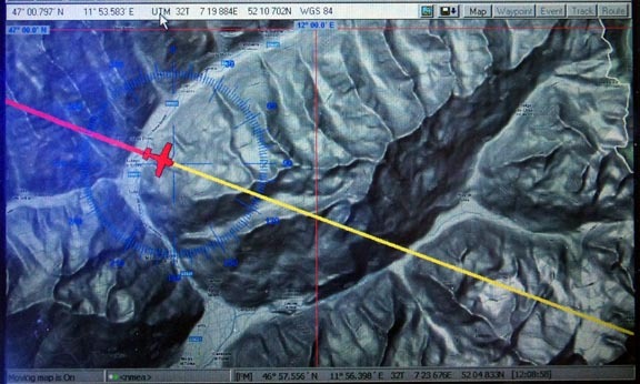
You can also get real topo detail but one would not use that in this context e.g.
GPWS is great too of course, but if you need that to routinely avoid a hill then you have a problem 
BTW my comment on topo charts was in the context of doing a DIY let down, not to avoid hills during cruise which would be a really stupid way to fly at low level.
Peter wrote:
a 299ft tower can go up without publication
Also on the half million chart the contours are at 500 feet intervals, so in theory you could get a 798 foot AMSL obstacle (399’ plus 299’) in a low lying area with no contour, that is neither on the chart or on the obstacle databases. While I am not aware of such an obstacle just at the 798’ level, I can think of a few in the 600 ~ 700 foot range which are unmarked, and will never be marked as they are not required to be.
A complimentary subject is planning your VFR MSA. Most reporting stations are at airports which are not on high ground so it is a reasonable expectation that ceilings may be lower between stations. The 3000’ AMSL minima is 5 km visibility and 1,000’ vertical separation from clouds, so arguably a half mill obstacle altitude of 1200’ might require a ceiling of either 2200’ or 2700’, allowing for 500’ obstacle clearance and a reasonable vertical separation from cloud. A 2500’ obstacle area would require a 4000’ ceiling to be legal, not counting higher minima for built up areas. 7km visibility and at ceilings comfortably above obstacles, which in lower lying areas probably means around 2500’ seems to me baseline for VFR. When conditions are worse, either go IFR, or put yourself into planning mode to either scrub the flight or be ready to plan a precautionary landing. I have headed off towards good VFR weather with ceilings around 1,000’, but the transit was around 10 miles and with good visibility. I would be making a diversion if heading towards marginal weather VFR. EU-OPS has a 3km visibility minima for commercial flights in VMC and this seems a good red line minima for VMC.
Propman thank you for starting the thread – allowing a range of opinions hopefully will improve planning decisions.
In Scotland nobody does “scud running”, but if we didn’t fly VFR when “cloud covers hills”, we would hardly fly at all. The trick of operating at minimum level is to have a decent plan B, and to put it into operation early – long before plan C (precautionary landing with power) becomes necessary. This year I’ve had to turn back twice between Glenswinton and Prestwick (34 miles) – it’s good practice for real mountain flying.
Not scud running in a Husky in the Highlands. :-)
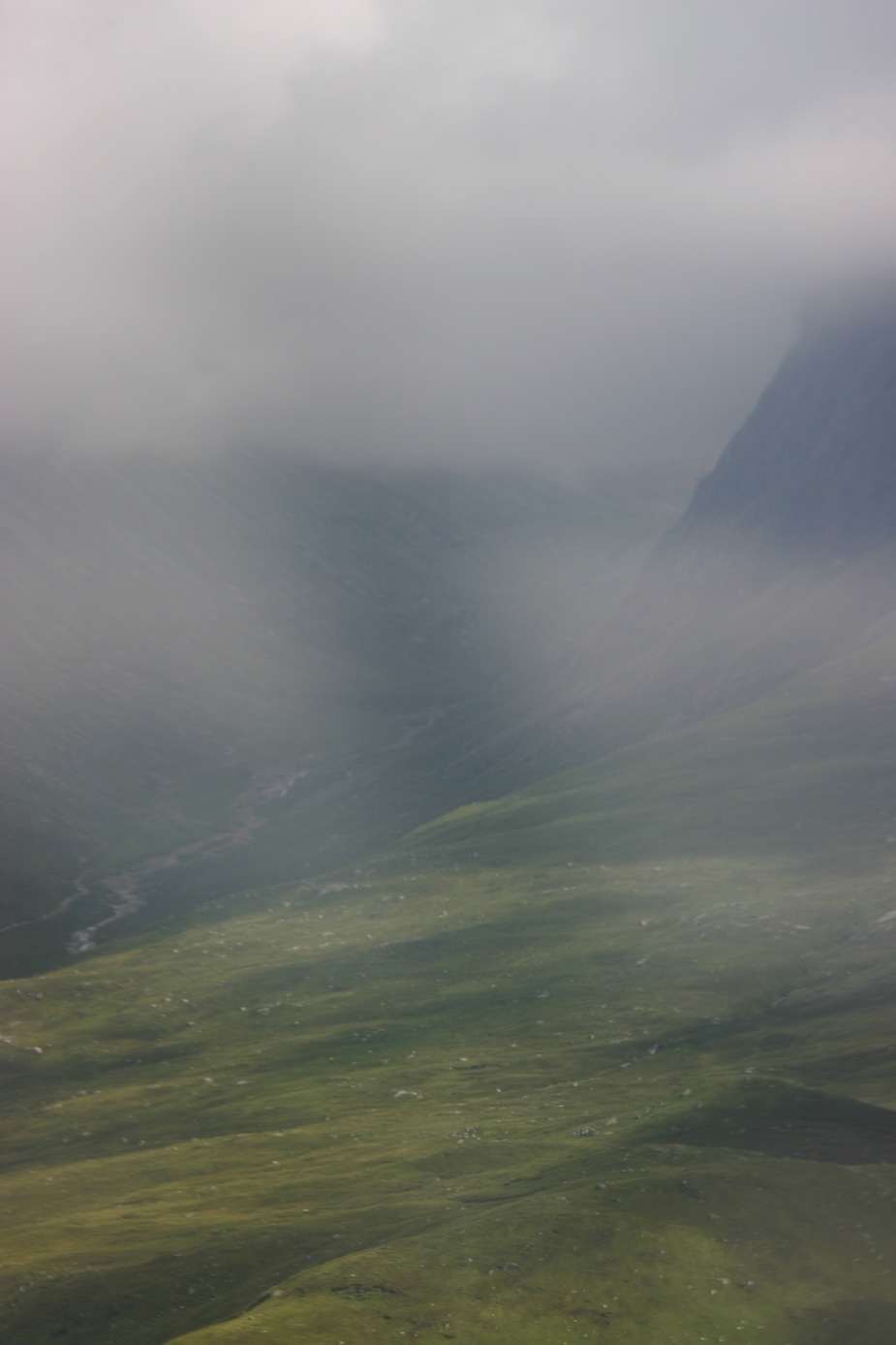
It looks like “scud running” is what we consider good flying conditions in Norway also. I have included 2 pictures from when the weather was nice. Overcast 1000-1500 ft in the first one, which make you follow the, sometimes narrow, valleys (I took the picture because it looked kind of like a volcano with the clouds , didn’t quite capture that with my phone). The other one is also 1000-1500 ft overcast but with rain showers and scattered low stratus. In these conditions it is important to have good topological info on the maps because the only danger is getting trapped in a valley.

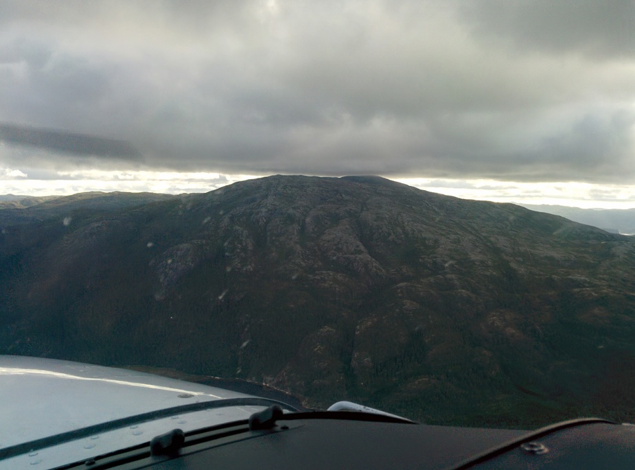
Fuji’s picture makes me feel quite ill. LeSving’s seems a nice flying day to me, as well.
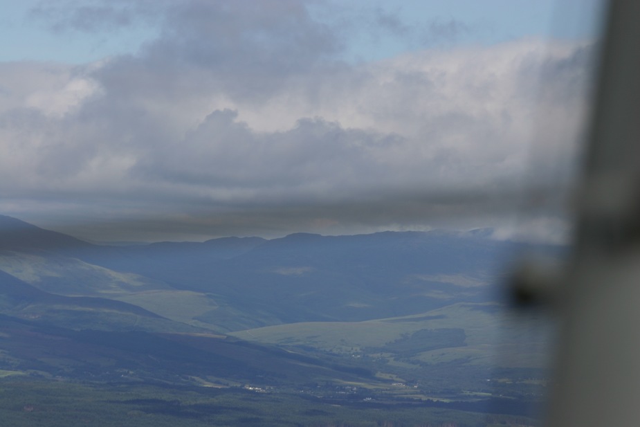
Same flight, which shows the variation in conditions.