
I would not have done it (flown via LFMP which was Plan B, avoiding the Alps completely) or turned back and flown to LFMP.
The funny thing is that FL170 would have cleared everything, by about 800ft. But the air was too warm. I saw exactly the same scenario 2 years ago – again -5C at FL160 – but the tops were FL158 
The best approach is to climb high enough to see right across the Alps. Plus 1000 feet, because even stratus cloud tops naturally rise as the day goes on, quite easily by a few tens of feet per minute.
On the route chosen, the terrain is a long way below – around 9000ft if the shortcuts are not taken – and the crossing is the shortest possible of the Alps, at around 30 minutes. So you get good escape routes for emergencies.
Envy !
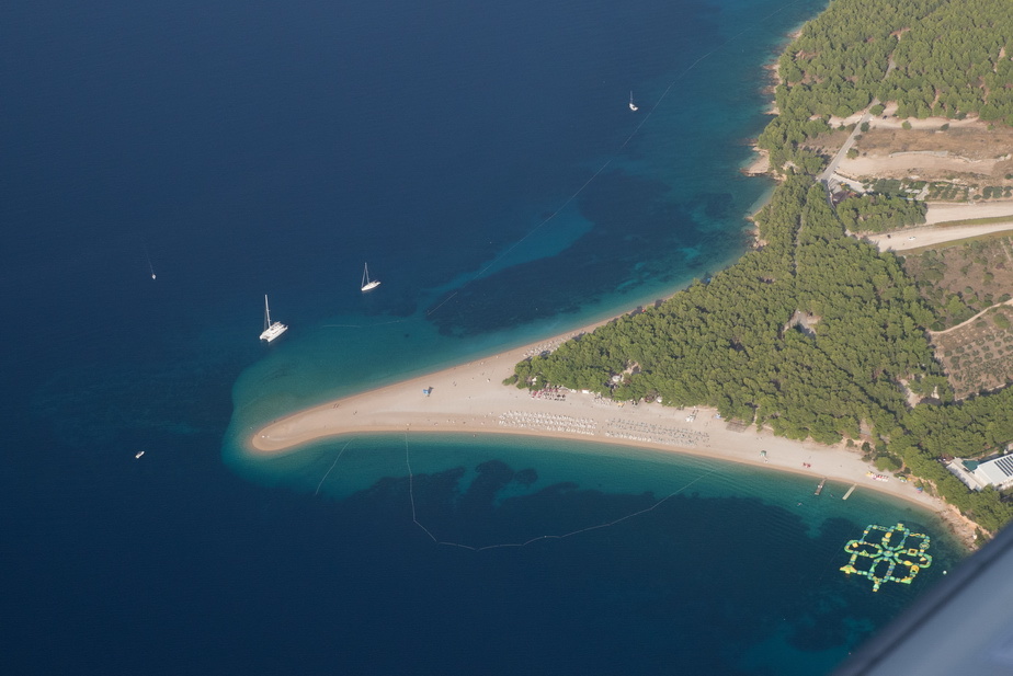
The picture of Golden Cape (at Bol below Brac LDSB airport) is really stunning. You can sell it to Croatian Ministry of Tourism
Amazing photos! Looks like it was a great trip!
The picture of Golden Cape (at Bol below Brac LDSB airport) is really stunning. You can sell it to Croatian Ministry of Tourism
I would think they can do better with a drone these days
The trick would be to get the pic without it being covered in bodies I did get one – early morning departure – but I am not sure if the quality is good enough.
Looks like it was a great trip!
It was but it was really great to be back home. The long trip back is always a bit tedious – probably because I structure these trips to have a quick but boring return journey. The ideal situation would be LGKJ-EGKA (about 1600nm) with a ferry tank
Peter wrote:
The trick would be to get the pic without it being covered in bodies
Peter wrote:
The ideal situation would be LGKJ-EGKA (about 1600nm) with a ferry tank

Peter wrote:
This is probably Montenegro
Tivat LYTV with its legendary approach.
Peter wrote:
Skopelos
Skiathos LGSK
Peter wrote:
Tanagra or Tatoi?
Tatoi LGTT


