Timothy wrote:
I have bought Jepp enroute charts in GP
Timothy wrote:
But nowhere do I see how to select the Jepp chart
I do not remember where I saw it written but I’m pretty sure that there are no Jeppesen Enroute charts in GP. If you want enroute charts you have to buy the AIP versions of each country. Your Jeppesen subscription only gives you access to your approach (arrival/departure/aerodrome) charts in GP.
Flyamax wrote:
I do not remember where I saw it written but I’m pretty sure that there are no Jeppesen Enroute charts in GP. If you want enroute charts you have to buy the AIP versions of each country. Your Jeppesen subscription only gives you access to your approach (arrival/departure/aerodrome) charts in GP.
So I paid 120 currency units to get the free AIP charts? What a rip off :-(
I had a long chat with Catherine at Garmin. Firstly she agreed that the Charts are just the AIP ones. She thinks that Jepp don’t do them any more. Anyway, she has refunded them and removed them from my sub.
Then we went on to discuss the ease, or rather difficulty, in building the charts needed for a flight, so I made her a little video of how it works in JeppFD and how easy it is.
For those of you who have not used JeppFD, here it is:
Would Garmin have been buying AIP terminal charts from Jepp?
Didn’t Garmin embark on a project to create their own terminal charts, so as to avoid paying the huge Jepp prices? We have had various discussions of that and I never believed they would actually do it, due to the massive effort and the small return given that most professional pilots (who actually pay for this data) just use Jepps without a concern for the cost.
Timothy wrote:
So I paid 120 currency units to get the free AIP charts? What a rip off :-(
You paid 120 currency units for georeferenced AIP charts. They are available for free as PDFs in the AIP, but are not georeferenced. It is not obvious to me that the PDFs of the AIPs allow derivative works and its reproduction/redistribution, so it is legally possible Garmin / their supplier actually has to pay a licence fee to the AIS / Eurocontrol / … I don’t expect so, though.
Peter wrote:
Would Garmin have been buying AIP terminal charts from Jepp?
No from Jeppesen, I believe. From another supplier, or they have been compiling them, and geo-referencing them, themselves? From what Garmin wrote to me, I believe it is an external supplier.
Peter wrote:
Didn’t Garmin embark on a project to create their own terminal charts, so as to avoid paying the huge Jepp prices?
Not that I know of; just the geo-referenced AIP ones. But you can have more information than me.
Much as I like GP, it doesn’t suit every flight that I make. It would be nice if EasyVFR and/or SkyDemon could also play Connext with the Garmin navigators.
As a “dominant supplier” I wonder whether Garmin might actually be obliged (under Title VII TFEU) to open its Connext protocol to other tablet app vendors?
Didn’t Garmin embark on a project to create their own terminal charts, so as to avoid paying the huge Jepp prices? We have had various discussions of that and I never believed they would actually do it, due to the massive effort and the small return given that most professional pilots (who actually pay for this data) just use Jepps without a concern for the cost.
Of course, they never did. What they did is creating the marketing name “Garmin FliteCharts”, alluding that they would create charts themselves, but it was just their name for the embedded AIP charts feature in their app.
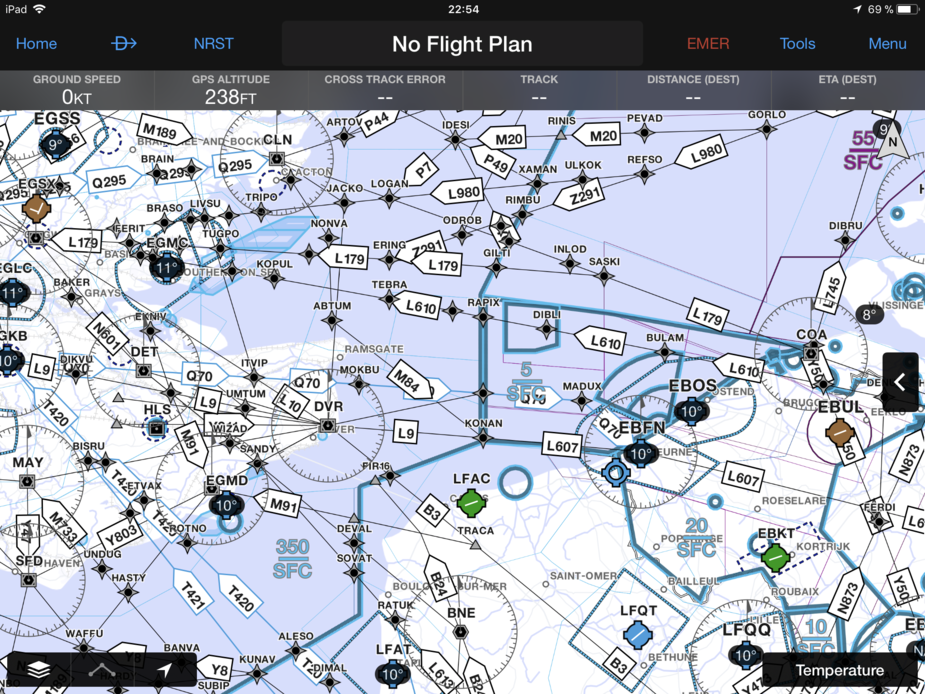
I think that there is confusion here. The 120 currency units was for enroute charts, as shown above:
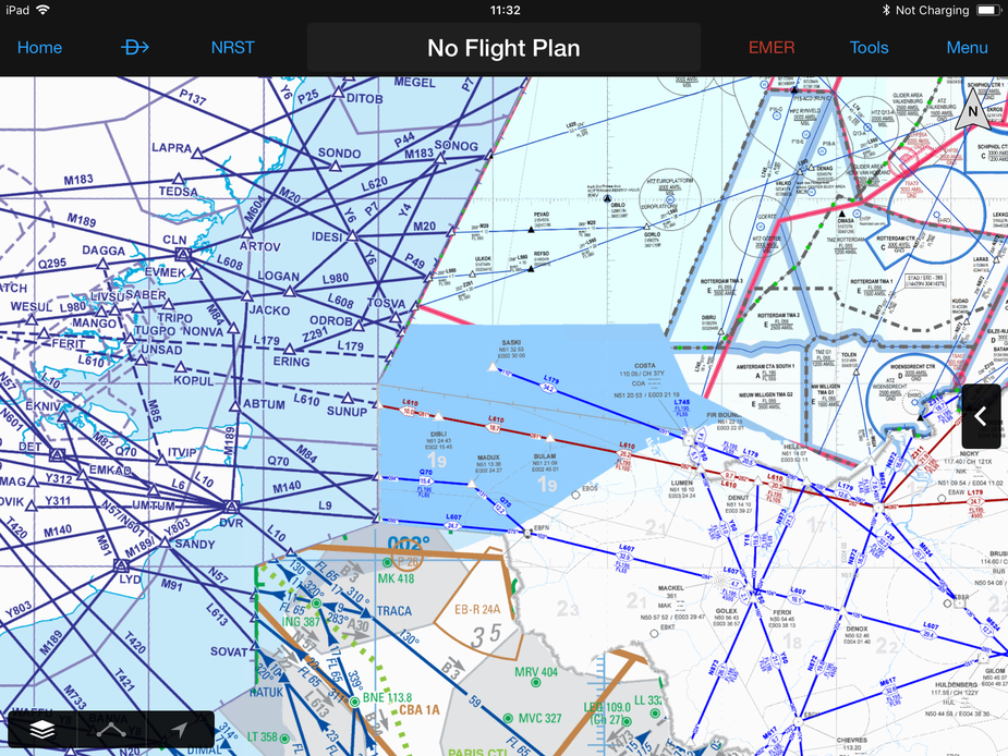
Which is the IFR areas charts from each AIP (which is why they look different) georeferenced.
It is confusing, because the video is about terminal charts, sorry.
Sure; Garmin took the AIP charts and spent some money on “cheap labour” to georeference them. They are probably the nth company to do that process  I can see there is some value to the user in that, compared to the free AIP charts which cannot be run as a moving map.
Of course the real issue is Jepp terminal chart pricing which has never deviated from their usual structure, no matter which product it is displayed in,
Timothy’s enroute charts (see his pic above) can be generated from free Eurocontrol data. Skyvector have done that, and the Autorouter has done it too. The main software challenge appears to be positioning the text labels intelligently. Garmin could easily do this product themselves if they wanted to.
I am not aware that Jepp ever made their paper enroute charts (the ones which they have been selling since for ever, and bundled them into the terminal chart subscriptions (both the printed and the DVD versions)) available in an electronic format, although of course the data exists in their various products e.g. Flitestar, Jeppview, JeppFD…
You could use the IFR theme in pilot …